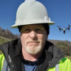
Aerial Image Systems was founded by Curtis Hildebrand in 2017 and has been in the Aviation Profession as a USAF C-130 Crew Chief 92′ to…

Professional, trusted and quality services. Specializing in residential, commercial and property Real Estate – Ground, Interior and Aerial – Photos and Videos. Quality high resolution…

Drone services in Green Bay Wisconsin. If you need a Drone Operator in the area, contact me on Drone.vet!

From the mountains, to the valleys, and everything in between, we’ve got you covered for your cinematic needs.

Join today for Full Access!
Don't see a pilot in your area? That's because you're in a limited view. Registered users see our entire pilot directory! Sign up today!
Sign Up


 Roseville, California
