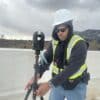
I use a DJI M30T Drone and Autel EVO 2 Dual Thermal Drone for my thermal work. I can shoot up to 8k video 48mp…

I have been flying drones for more than 5 years professionally, specializing in law enforcement, public safety, search and general video and photography. My business…

At Northeast Aerial Solutions, we take pride in providing top-notch aerial photography and video services to our clients. As a Part 107 certified and insured…

Travel is per hour after the first hour of travel. I am willing to travel as far as needed, provided the pay is right.

Join today for Full Access!
Don't see a pilot in your area? That's because you're in a limited view. Registered users see our entire pilot directory! Sign up today!
Sign Up


 Humble, Texas
