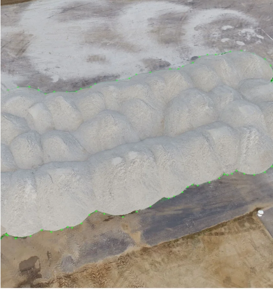
At Aerial inSight LLC in New Mexico, our Volumetric Measurement services use advanced drone technology and photogrammetry to deliver precise data for material management and site evaluation. By capturing high-resolution aerial imagery and processing it into accurate 3D models, we help businesses measure stockpiles, excavation volumes, and earthwork quantities with speed and accuracy.
Traditional ground-based methods are time-consuming and often prone to error. Our aerial volumetrics significantly reduce field time while improving accuracy, allowing project managers, engineers, and construction teams to track material movement, monitor progress, and plan operations efficiently. Whether you’re managing aggregates, soil, or construction debris, our reports provide clear volume calculations and visual references to support decision-making.
Every project is tailored to your specific site needs. We conduct thorough pre-flight planning, apply ground control points (GCPs), and use professional-grade software to ensure precise, repeatable results.
With Aerial inSight LLC, you gain actionable insights that help optimize logistics, control costs, and maintain transparency with stakeholders.
💲 contact Aerial inSight LLC in New Mexico today for a personalized quote.