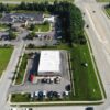
Zenith Drone Services can provide aerial photography and photogrammetry services to a broad range of
disciplines. With over 20 years of experience in construction, site inspection, environmental assessment, site surveying and photography,
we are ready to provide visual and mapping insight for your project. Utilizing the latest in drone technology and advanced software to ensure accuracy and precision in every aspect of our work.
HOW WE CAN ADD VALUE TO YOUR PROJECT
Through our state-of-the-art technology ZDS can provide real-time information in a visual format. Our services can reduce costs, delays and client disputes. If there is something specific, reach out to us and we will happily discuss options of how Zenith Drone Services can assist you.
Travel upto 50 Miles

