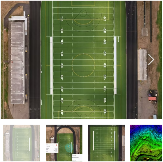
Orthomosaic mapping is one of the most accurate and efficient ways to capture large areas with precision, and Teslas Drones in Tacoma, Washington specializes in delivering high-resolution, georeferenced orthomosaic maps tailored to professional industry needs. Using advanced drone photogrammetry, we capture hundreds or thousands of overlapping aerial images that are processed into a single, distortion-free map with exceptional clarity. Our orthomosaics provide centimeter-level accuracy, making them perfect for land development, construction planning, environmental analysis, agriculture, infrastructure monitoring, and municipal planning.
These maps offer detailed insights into terrain, structural positioning, vegetation, and site conditions. With the ability to zoom in and analyze specific features, teams can measure distances, calculate areas, detect changes, and create accurate reports. Orthomosaics significantly reduce the time and cost associated with traditional ground surveying while improving safety by minimizing the need to navigate challenging or hazardous terrain.
Teslas Drones ensures consistent quality, fast turnaround, and dependable data presentation that integrates easily into GIS software, CAD platforms, and planning tools. Whether you’re surveying a development site, monitoring progress on a construction project, or conducting environmental studies, our orthomosaic solutions help you work smarter, faster, and more accurately.
Orthomosaic maps are the heart to creating roof reports, agricultural health maps, terrain maps, 3D models, and much more!
This innovative technology combines satellite geolocation, AI algorithms, and cloud-based computing services to produce a highly accurate and up-to-date aerial image of a property like the ones you see to the left.
With an accuracy rate of 99.4%, these 2D digital models allow for precise measurements of height, depth, length, area, and volume. This information can be used for a variety of purposes, such as measuring stockpiles, conducting equipment and infrastructure inspections, monitoring site progression, and detecting plan deviations.