
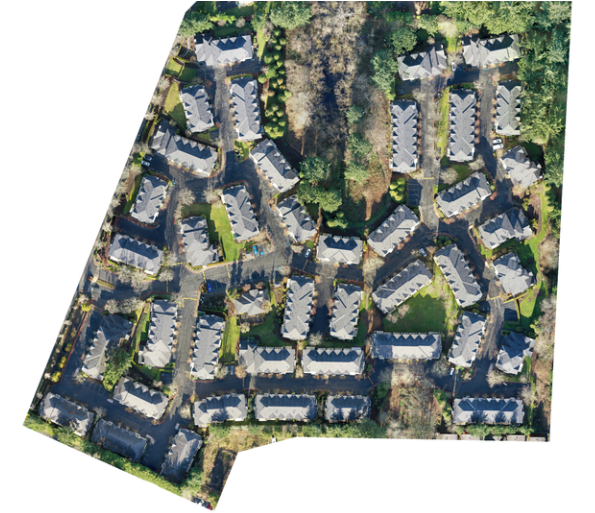
At MorLo Aerial Imaging in Washington, we pride ourselves on delivering exceptional quality and accuracy across every drone service we provide. From high-resolution photography to precision mapping, our work is defined by clarity, consistency, and professional-grade detail that meets the highest industry standards.
We utilize advanced drone systems, calibrated sensors, and rigorous quality control to ensure that every image, video, and dataset is precise and reliable. This commitment to excellence supports industries such as construction, surveying, real estate, and inspection—where accuracy is crucial for decision-making and compliance.
Our post-processing workflows enhance color balance, detail, and spatial accuracy, ensuring that every deliverable is not only visually impressive but also data-rich and actionable. Whether documenting progress, marketing a property, or mapping terrain, our results stand out for their sharpness and reliability.
With MorLo Aerial Imaging, you gain more than visuals—you gain confidence in every pixel, measurement, and report.
💲 Pricing is custom—contact MorLo Aerial Imaging in Washington today for a personalized quote.