
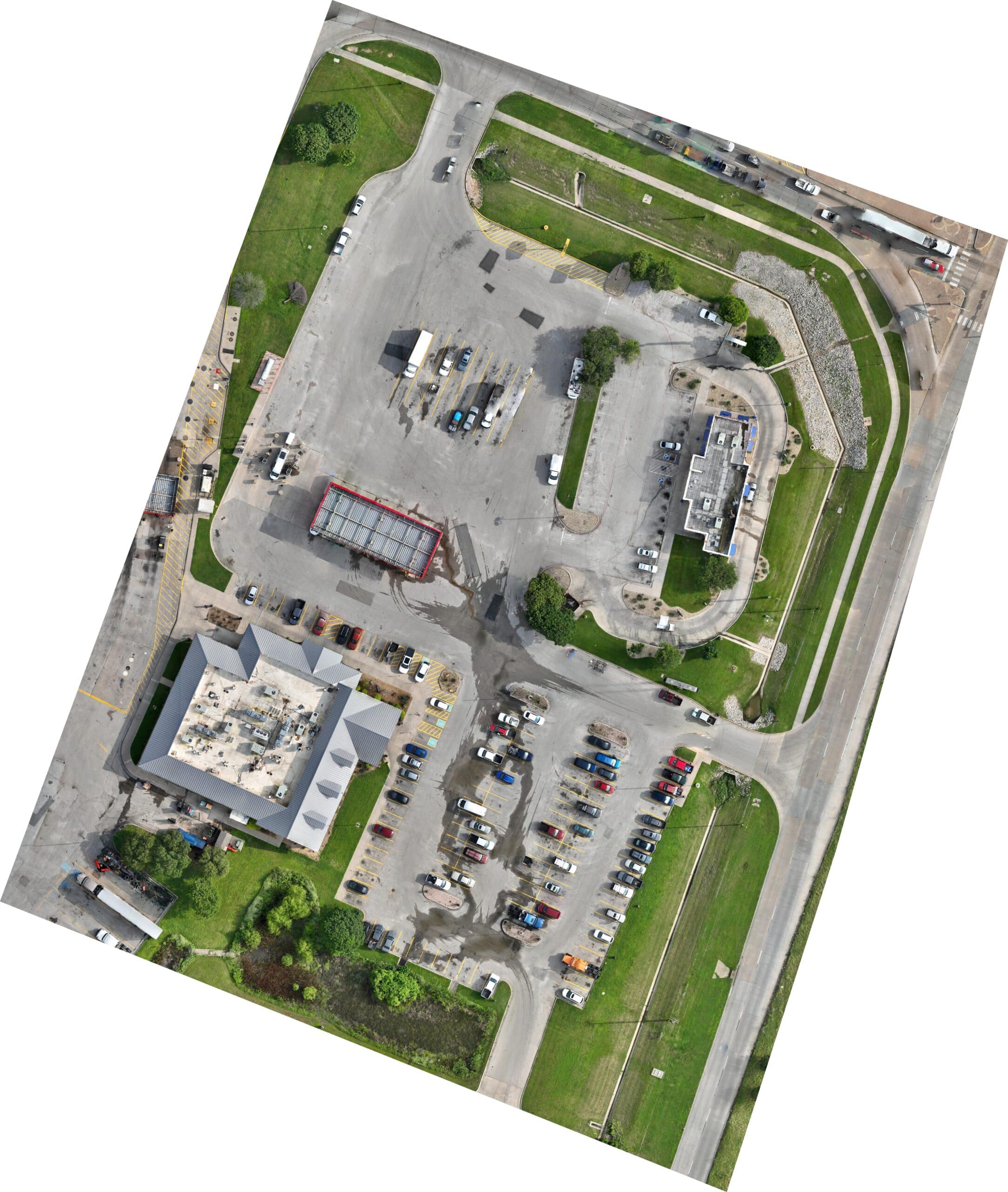
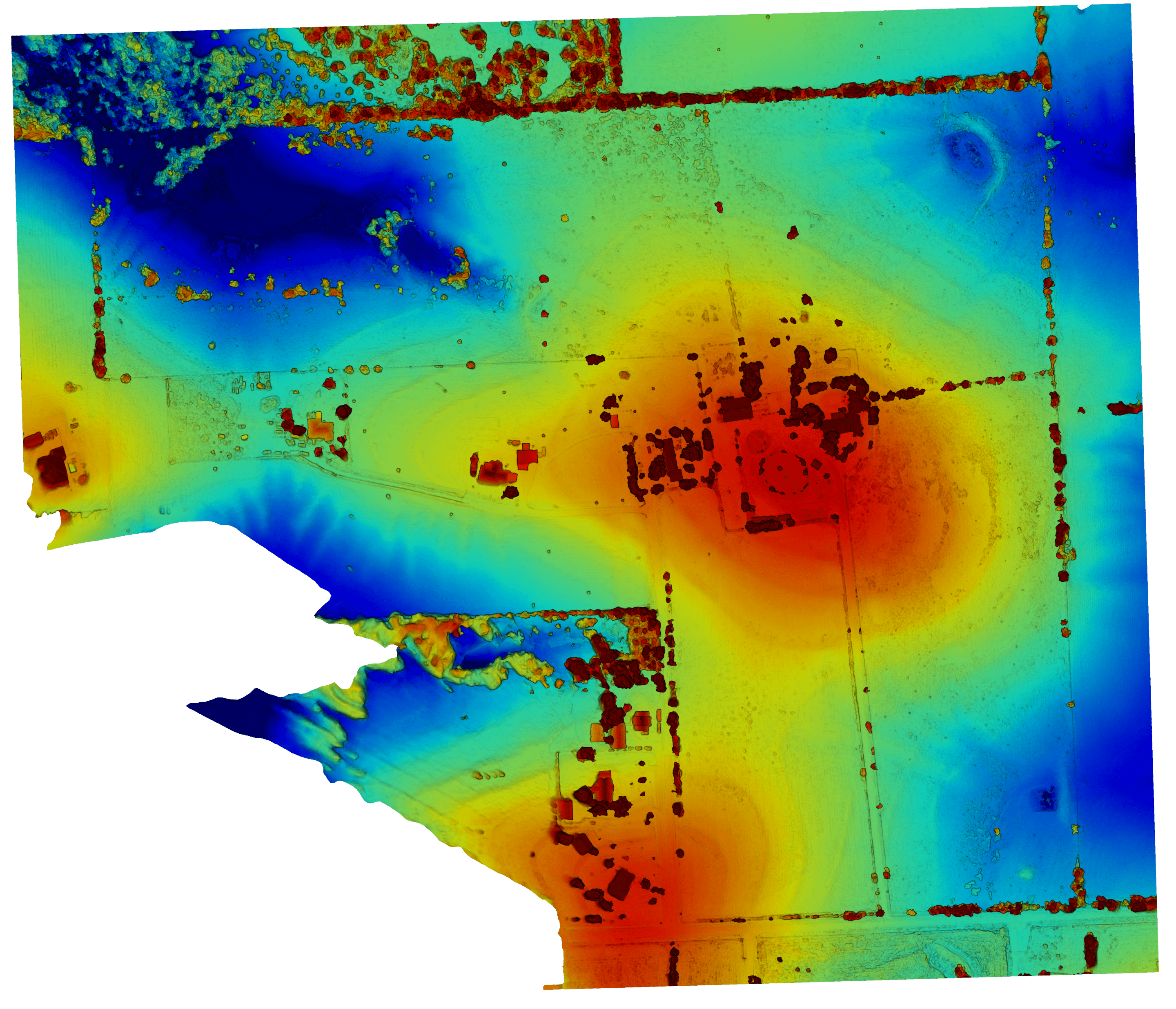
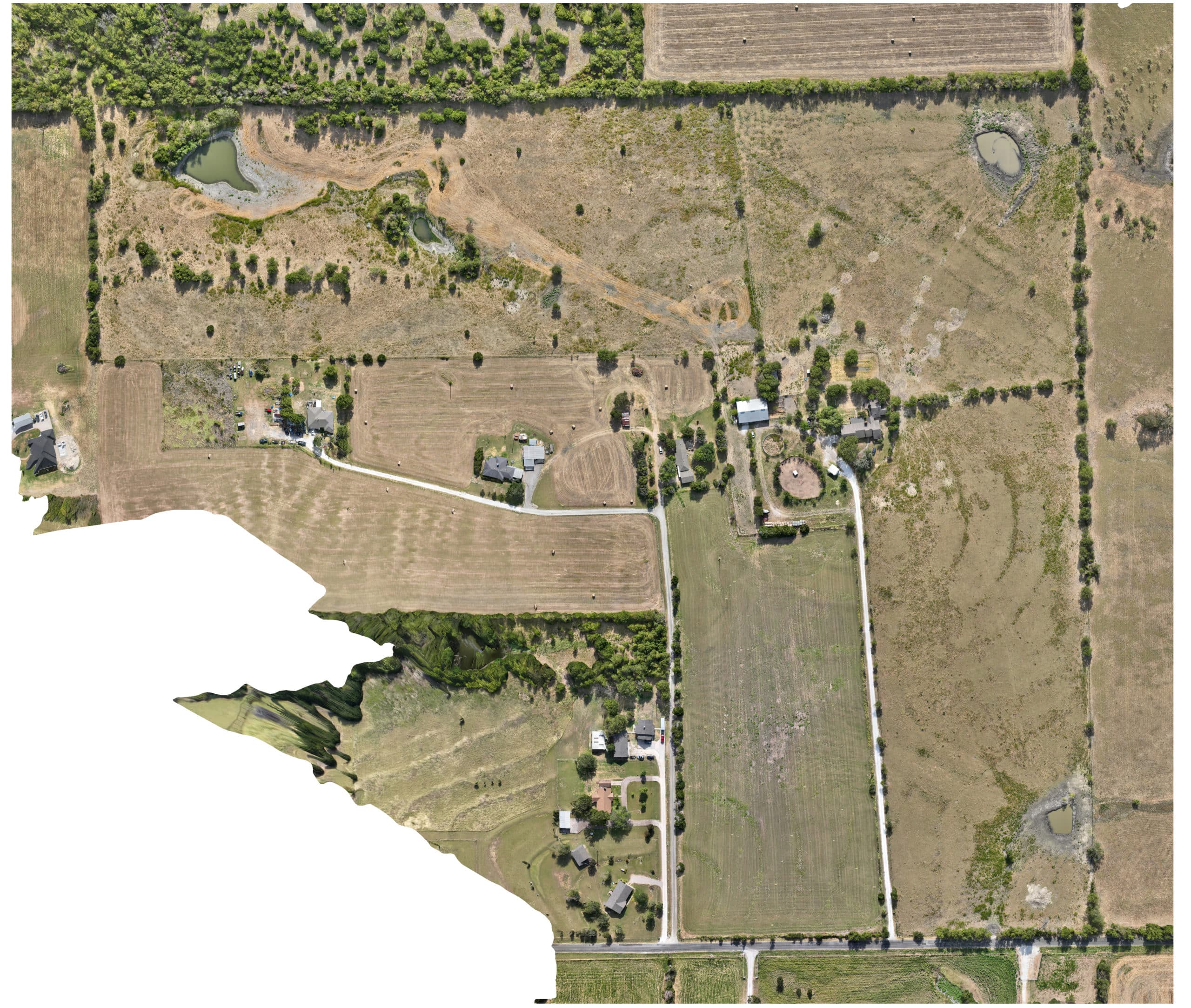

Timothy Butler offers comprehensive drone mapping services in Texas that deliver precise and actionable insights for projects of any size. Whether you need orthomosaic maps, 3D modeling, or construction progress tracking, our aerial mapping solutions are designed to meet your project's needs with accuracy and efficiency.
Our drone mapping process captures high-resolution overlapping imagery across your site in a single flight, which is then processed using advanced software to produce detailed, measurable outputs you can use for planning, analysis, and reporting.
Services offered include:
- Orthomosaic: High-resolution aerial maps for detailed site analysis, ideal for land development, agriculture, and large-scale property assessment.
- Mapping: Comprehensive drone surveying for a variety of projects, from small residential lots to expansive commercial sites.
- 3D Modeling: Create accurate 3D site mapping models for planning, design, and analysis, giving you a clear visual representation of existing conditions.
- Construction Progress: Monitor construction site progress with regular aerial updates, helping you track timelines, verify milestones, and keep stakeholders informed.
These services support a wide range of industries, including construction, real estate, land development, and agriculture. Every flight is conducted by an experienced, FAA-certified pilot who tailors the mapping approach to your site's terrain, scale, and project goals — ensuring deliverables that are both accurate and easy to act on.
Let us help you take your project to the next level with our advanced drone mapping services in Texas. Contact us today to discuss your mapping needs, confirm pricing, and secure your booking — and let us help you present your project in the best possible way.