Construction Progression by Palmetto Aerial Productions LLC
-
0 sales
- 7 views
- 3 Hours Response time
- $0.00 No travel charge
- Save
0 /5.0
User review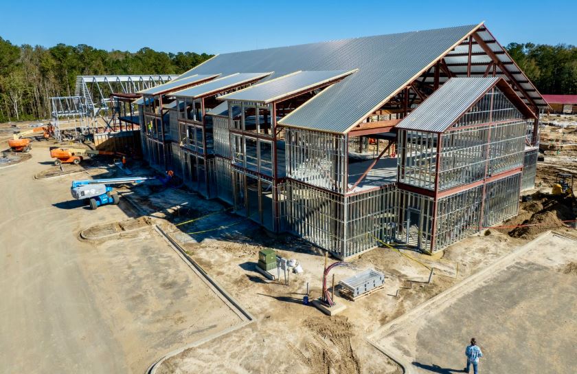

Palmetto Aerial Solutions strives to provide the greatest quality media with cutting edge technologies.
We use aerial imaging to help construction companies, landscape companies
and investors better manage resources, make well-informed decisions,
track work flow/schedules, show progress to constituents, and save money
throughout the process. Stakeholders or clients of the companies building
the project can be able to see this progress from anywhere in the world.
Keep your investors informed of progress through detailed imagery.
Aerial photographs show all of the details of the site and/or surrounding area.
This aerial imaging also provides an excellent measurement of construction progress for both construction companies and investors.
We specialize in tracking your progress from ground breaking to completion.
We use the latest UAVs (drones) to take photos or videos each week, month, or year as needed for your construction progress.
Many of these weekly or monthly photos or videos utilize pre-programmed GPS coordinates from the first site visit and will use those exact same coordinates until the project is completed.
This allows for time-lapse video of the project for you or your clients' marketing needs or for a permanent record.
Aerial imaging can also be used for architectural planning including landscape planning, documentation of as built features,
or placing a virtual home on a lot to accurately visualize how its placement fits on the particular lot.
UAV imaging provides the benefit of helping to document construction,
which may help promote the quality of work and increase future sales.
These images can assist in facilitating the design and development plan of action and can be used before, during,
and after completion of the land or structure being developed.
This is a valuable tool which can help plan for future projects and/or promote the success of work completed leading to an increase in future business.
Aerial imaging can also be used for architectural planning including landscape planning, documentation of as built features,
or placing a virtual home on a lot to accurately visualize how its placement fits on the particular lot.