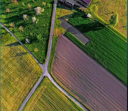
At Prynce of the Sky Aerial Imagery, we bring cutting-edge drone technology to the heart of Iowa’s agriculture, helping farmers make smarter, data-driven decisions. Our agricultural aerial imaging services provide high-resolution aerial maps and detailed crop health analyses that reveal critical information invisible from the ground. Using advanced multispectral imaging and elevation mapping, we help identify issues such as uneven irrigation, pest infestations, nutrient deficiencies, and soil variation early in the growing season. These insights empower farmers to optimize fertilization, planting strategies, and water management, leading to higher efficiency and improved yields.
Our aerial surveys also allow for comparative imaging, showing crop progress and field changes over time—helping detect patterns that affect production. Each image is georeferenced and captured with precision, providing reliable data for accurate analysis and documentation. Whether managing large commercial farms or smaller family operations, farmers across Iowa trust our services to enhance sustainability and profitability. By transforming aerial data into actionable insights, Prynce of the Sky Aerial Imagery ensures that your fields perform at their best—season after season. With our expertise, Iowa’s agricultural professionals gain the clarity and confidence to make informed, timely, and cost-effective decisions.