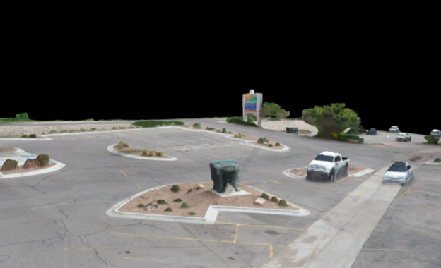

Aerial inSight LLC in New Mexico provides 3D Modeling services that transform aerial imagery into detailed, photorealistic representations of terrain, structures, and built environments. Our drone-generated 3D models offer planners, engineers, and designers a dynamic way to visualize sites from every angle and analyze complex spatial data.
These models enable precise measurements, volume calculations, and terrain analysis, supporting informed decision-making throughout planning, construction, and maintenance. With accurate elevation data and texture-rich surfaces, you can simulate scenarios, detect design conflicts, and present projects with visual clarity.
Our 3D models integrate seamlessly with GIS, CAD, and BIM platforms, ensuring compatibility with your existing workflows.
With Aerial inSight LLC, you gain actionable insights that improve communication, reduce risk, and accelerate project delivery.
💲 contact Aerial inSight LLC in New Mexico today for a personalized quote.