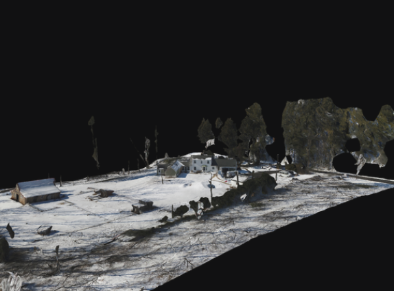
Transform physical spaces into digital assets with 3D Modeling services by Aerial Imagery Solutions LLC. Using advanced photogrammetry and drone mapping technology, we create accurate, high-resolution 3D models of buildings, landscapes, and construction sites. These models are invaluable for architecture, engineering, real estate visualization, and urban planning.
Our drones capture overlapping aerial imagery, which is processed using specialized software to generate detailed 3D representations that reflect real-world dimensions and textures. Clients can use these models for measurements, project documentation, and virtual walkthroughs—streamlining workflows and improving collaboration between teams.
Whether you’re tracking site progress, planning new developments, or creating visual simulations for investors, our 3D models provide precision and clarity unmatched by traditional methods.
Located in Maryland, Aerial Imagery Solutions LLC combines innovation and expertise to deliver 3D mapping solutions that enhance accuracy, save time, and elevate your project presentation. We turn data into dimension—helping you visualize, analyze, and plan with confidence.