Home
Find By Categories
Explore projects by categories
View All
Infrastructure & Construction
Construction Site Monitoring
Dam & Reservoir Surveillance
Energy & Utilities Monitoring
GIS & LiDAR
Infrastructure Assessments
Transport & Logistics
Urban Planning & Development
Surveys & Inspections
Mapping & GIS
Orthomosaics
Photogrammetry
Roof Inspections
Solar Inspection & Survey
Thermal Imaging
Topographic Survey
Tower Inspection
Real Estate
3D Virtual Tours
Commercial Real Estate
Investment Property
Large Estates & Mansions
Real Estate Photography
Residential Real Estate
Vacant Land
Explore services by categories
View All
Tourism & Travel
Adventure Tourism
Destination Marketing
Resort & Hotel Promotion
Agriculture & Farming
Agricultural drone mapping
Agricultural Shows & Events
Crop Monitoring
Livestock Recovery
Livestock Surveillance
Environmental & Conservation
Coastal & Marine Surveys
Disaster Assessments
Environmental Impact Studies
About Us
Explore projects by categories
View All
Infrastructure & Construction
Construction Site Monitoring
Dam & Reservoir Surveillance
Energy & Utilities Monitoring
GIS & LiDAR
Infrastructure Assessments
Transport & Logistics
Urban Planning & Development
Surveys & Inspections
Mapping & GIS
Orthomosaics
Photogrammetry
Roof Inspections
Solar Inspection & Survey
Thermal Imaging
Topographic Survey
Tower Inspection
Real Estate
3D Virtual Tours
Commercial Real Estate
Investment Property
Large Estates & Mansions
Real Estate Photography
Residential Real Estate
Vacant Land
Explore services by categories
View All
Tourism & Travel
Adventure Tourism
Destination Marketing
Resort & Hotel Promotion
Agriculture & Farming
Agricultural drone mapping
Agricultural Shows & Events
Crop Monitoring
Livestock Recovery
Livestock Surveillance
Environmental & Conservation
Coastal & Marine Surveys
Disaster Assessments
Environmental Impact Studies
How It Works
Explore projects by categories
View All
Infrastructure & Construction
Construction Site Monitoring
Dam & Reservoir Surveillance
Energy & Utilities Monitoring
GIS & LiDAR
Infrastructure Assessments
Transport & Logistics
Urban Planning & Development
Surveys & Inspections
Mapping & GIS
Orthomosaics
Photogrammetry
Roof Inspections
Solar Inspection & Survey
Thermal Imaging
Topographic Survey
Tower Inspection
Real Estate
3D Virtual Tours
Commercial Real Estate
Investment Property
Large Estates & Mansions
Real Estate Photography
Residential Real Estate
Vacant Land
Explore services by categories
View All
Tourism & Travel
Adventure Tourism
Destination Marketing
Resort & Hotel Promotion
Agriculture & Farming
Agricultural drone mapping
Agricultural Shows & Events
Crop Monitoring
Livestock Recovery
Livestock Surveillance
Environmental & Conservation
Coastal & Marine Surveys
Disaster Assessments
Environmental Impact Studies
Contact Us
Explore projects by categories
View All
Infrastructure & Construction
Construction Site Monitoring
Dam & Reservoir Surveillance
Energy & Utilities Monitoring
GIS & LiDAR
Infrastructure Assessments
Transport & Logistics
Urban Planning & Development
Surveys & Inspections
Mapping & GIS
Orthomosaics
Photogrammetry
Roof Inspections
Solar Inspection & Survey
Thermal Imaging
Topographic Survey
Tower Inspection
Real Estate
3D Virtual Tours
Commercial Real Estate
Investment Property
Large Estates & Mansions
Real Estate Photography
Residential Real Estate
Vacant Land
Explore services by categories
View All
Tourism & Travel
Adventure Tourism
Destination Marketing
Resort & Hotel Promotion
Agriculture & Farming
Agricultural drone mapping
Agricultural Shows & Events
Crop Monitoring
Livestock Recovery
Livestock Surveillance
Environmental & Conservation
Coastal & Marine Surveys
Disaster Assessments
Environmental Impact Studies
Distance in (Mile)
300
Pilots
Pilots
Jobs
Services
Sign In
Register
All Categories
Agriculture & Farming
Drone Delivery services
Emergency Services
Environmental & Conservation
Events & Ceremonies
Infrastructure & Construction
Photography
Real Estate
Sporting Events
Spraying
Surveys & Inspections
Tourism & Travel
Videography
Damage Assessment
Inspections
Drone Mapping
Boundary Surveying
Aerial Photogrammetry
Topographic Surveying
Drone Services
Drone Pilot Meg O
Home
Pilots
Meg O
Drone Certifications
FAA Part-107 Licensed Drone Pilot #4922051
Services
No services found
Drone Portfolio
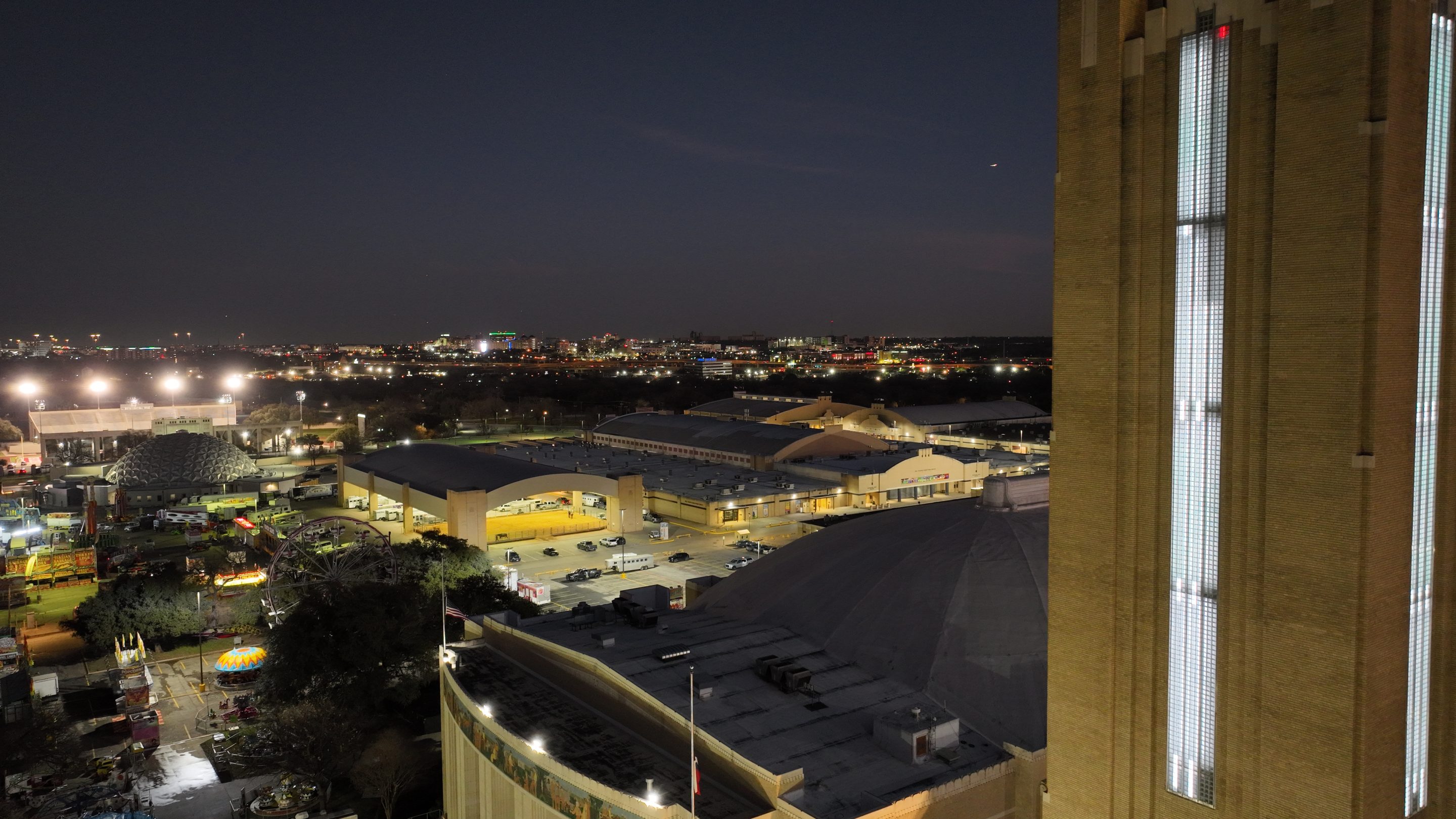
Fort Worth Stock Show Grounds
Education
Certification in Unnamed Aerial Vehicle Pilot
Texas State Technical College
August 5, 2024
Experience
Drone pilot
High Spike Rail Services
United States (US)
November 3, 2024
Choose User Type
Add credit to your wallet
Add funds now
*
You will be redirected to the checkout page to add your billing details.
Add FAQ
Add title:
Add description:
Click “Save & Update” to update your faq
Save & Update
Reject service approval request
Send
Choose User Type