
-

2D Floor Plans
-
Aerial Mapping Photogrammetry & Inspections
-
Aerial Photogrammetry
-
Aerial Photography and Videography
-
Drone Aerial Photography
-
Drone Photo & Video
-
Drone Photos
-
Ground & Aerial Photography
-
Mapping & Photogrammetry
-
Photography
-
Drone Photography & Videography
-
Surveys & Inspections
-

3D Mapping
-

Aerial Mapping
-
Photogrammetry
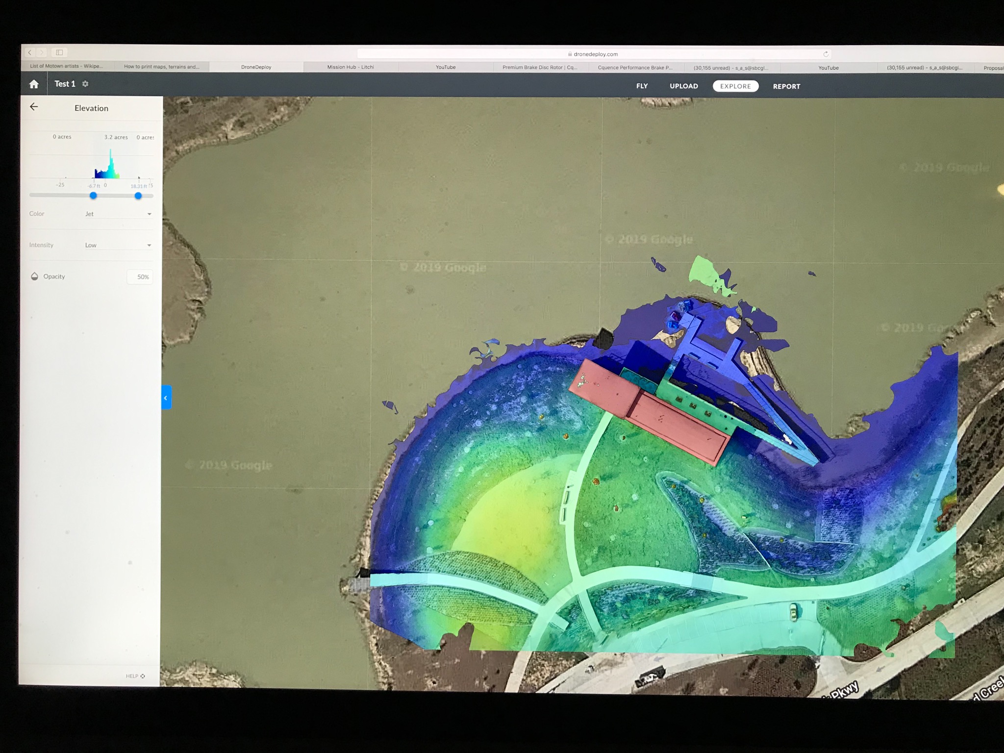
Gather accurate geospatial data and streamline land development planning with precision drone photogrammetry mapping in Seminole, Oklahoma. Stellar Drone Services deploys high-resolution camera payloads aboard remote aircraft to collect overlapping aerial datasets for construction progress monitoring, real estate development planning, land use management, and agricultural field audits. Our drone photogrammetry operations convert raw aerial photos into detailed 2D orthomosaic maps and interactive 3D spatial models.
Aerial photogrammetry empowers project managers, civil developers, and agricultural operators to evaluate land topographies, track site earthwork progress, and audit acreage without slow, manual ground surveys. Under the direction of an FAA Part 107 certified remote pilot, our flight team plans systematic automated grid flights over target locations to ensure high spatial accuracy and consistent data capture across every project phase across Texas and nationwide.
Key Details & Capabilities:
-
Drone Photogrammetry Mapping in Houston, TX: High-precision aerial photogrammetry for land development, construction, and agriculture.
-
2D & 3D Spatial Deliverables: Captures high-resolution imagery transformed into detailed 2D orthomosaic maps and 3D digital surface models.
-
Construction & Development Monitoring: Visual data logging for tracking site transformation, material placement, and project timelines.
-
Agricultural Field Surveys: Overhead spatial mapping assisting landowners with crop field layout, drainage reviews, and land management.
Location
Fequently asked questions
What deliverables are produced from drone photogrammetry mapping in Houston, TX?
Photogrammetry flights generate high-resolution 2D orthomosaic maps, digital surface models, and 3D terrain meshes.
How does aerial drone photogrammetry benefit construction project managers?
Aerial mapping provides project managers with precise overhead visual records to track site progress, audit earthwork, and share spatial data with stakeholders.
Are photogrammetry flight operations licensed and compliant with federal rules?
Yes, all aerial mapping missions are planned and operated by an FAA Part 107 certified commercial remote pilot.