
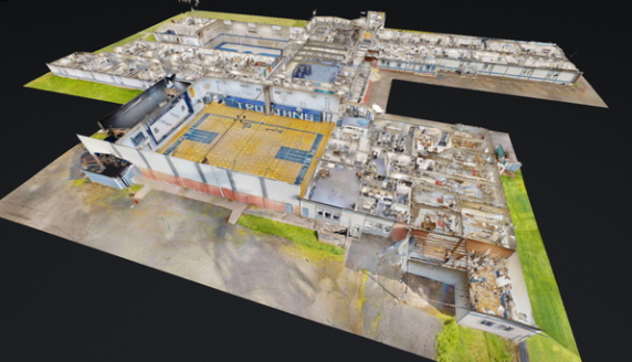

At MorLo Aerial Imaging in Washington, we create high-resolution 3D models and scans tailored for any industry, offering detailed digital replicas of physical spaces, structures, and landscapes. Using advanced drone photogrammetry and LiDAR technology, we capture accurate spatial data that supports engineering, architecture, construction, and asset management projects.
Our 3D models empower professionals to visualize projects, measure dimensions, plan designs, and detect potential issues before they escalate. From construction progress tracking and infrastructure development to environmental analysis and real estate visualization, these models deliver actionable insights and precision documentation.
With interactive viewing options, clients can explore every angle of their site remotely, improving communication among stakeholders and reducing on-site visits. Each scan is processed with cutting-edge software to ensure exceptional accuracy, scale, and clarity, making it ideal for presentations, planning, and reporting.
Trust MorLo Aerial Imaging to turn your physical environment into a dynamic digital asset that enhances decision-making and project efficiency.
💲 Pricing is custom—contact MorLo Aerial Imaging in Washington today for a personalized quote.