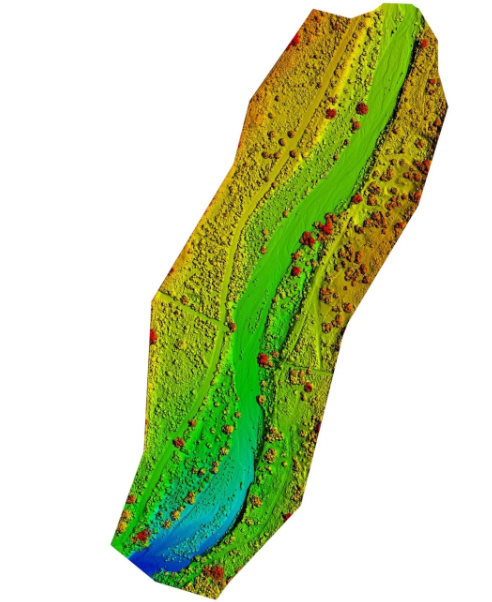
At Aerial inSight LLC in New Mexico, we offer Digital Surface Models (DSM) and Digital Terrain Models (DTM) that deliver accurate elevation data and terrain insights for your project. Using drone photogrammetry, we capture detailed topographical information to create high-resolution models ideal for planning, analysis, and monitoring.
A DSM includes natural and built features like vegetation and buildings, providing a realistic view of surface elevations—perfect for environmental studies, flood risk assessments, and site planning. A DTM, on the other hand, filters out these objects to reveal the bare earth surface, making it invaluable for grading, excavation planning, and land development.
Our team ensures each model is georeferenced and processed with precision, enabling accurate volume calculations, slope analysis, and site visualization. These datasets help engineers, architects, and planners make informed decisions with confidence.
Whether you’re managing a construction project, conducting feasibility studies, or mapping terrain, our DSM and DTM solutions offer clarity and efficiency at every stage.
💲 contact Aerial inSight LLC in New Mexico today to request a personalized quote.