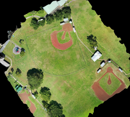

At Hawaii Pacific Drone Solutions in Hawaii, we specialize in advanced aerial mapping and surveying that transforms raw aerial imagery into actionable data. Our cutting-edge drone technology captures precise georeferenced images, which are processed into detailed orthomosaics, contour maps, and elevation models. These deliverables provide accuracy and clarity far beyond traditional surveying methods.
From land development and construction planning to agriculture and environmental monitoring, aerial mapping supports a wide range of industries. Developers can track site layouts, measure land boundaries, and visualize terrain changes, while environmental experts can analyze ecosystems with efficiency and precision.
The advantage of aerial surveying lies in speed and safety. Our drones can cover large or difficult-to-access areas quickly, eliminating the need for time-intensive ground surveys. Each map and survey is created with professional accuracy, providing reliable data for decision-making, planning, and compliance.
Whether for government agencies, engineering firms, or private projects, our mapping solutions empower clients to move forward with confidence.
💲 Contact Hawaii Pacific Drone Solutions in Hawaii today to book your aerial mapping and surveying services and request a tailored quote.