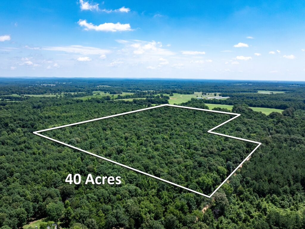
Advanced Mapping & Surveying Solutions with Drone.vet's Aerial GIS Services
Unlock the full potential of geographic information systems (GIS) with Drone.vet’s aerial mapping and surveying services. Our skilled licensed pilots utilize cutting-edge drones equipped with high-precision sensors to gather detailed geographic data that is essential for spatial analysis in various sectors, including urban planning, environmental management, agriculture, and civil engineering.
Innovative Approach to Mapping and Surveying
Drones have revolutionized traditional surveying methods, offering a multitude of advantages that enhance the quality and efficiency of spatial data collection:
Comprehensive Coverage: Drones can quickly cover large and often inaccessible areas, providing detailed topographic data that is crucial for accurate mapping.
High-Resolution Imagery: Equipped with advanced cameras, our drones capture high-definition images that offer finer details for more precise mapping and analysis.
Cost-Effective Data Collection: Aerial surveying with drones reduces the need for extensive manpower and the costs associated with traditional field surveys.
Versatile Data Integration: The data collected integrates seamlessly into GIS software, supporting a wide range of applications from urban development projects to environmental conservation efforts.
Reduced Environmental Impact: Our drones conduct surveys without disturbing the natural environment, making them ideal for sensitive ecological areas.
Drone.vet’s GIS Mapping and Surveying Services Include:
Land Use and Zoning Analysis: Support urban planning and development with accurate, up-to-date data on land use patterns and zoning regulations.
Environmental Monitoring: Track changes in ecosystems, monitor wildlife habitats, and assess water quality and vegetation health.
Agricultural Mapping: Optimize farm management practices with detailed analyses of soil composition, crop health, and field conditions.
Infrastructure Planning: Aid in the design and construction of infrastructure by providing precise measurements and situational awareness of the project area.
Disaster Management and Response: Quickly map affected areas in the aftermath of natural disasters to aid in effective response and recovery operations.
Why Choose Drone.vet for Your Mapping and Surveying Needs?
At Drone.vet, we are committed to delivering high-quality and reliable GIS mapping and surveying services. Our team of experts leverages the latest drone technology to ensure comprehensive data collection that meets the specific needs of our clients. We pride ourselves on precision, efficiency, and adaptability, handling projects of all sizes and complexities with the utmost professionalism.
Get Started with Drone.vet Today
Enhance your GIS capabilities and streamline your spatial projects with Drone.vet’s professional aerial mapping and surveying services. Contact us to learn more about how we can assist you, or visit our website to explore our full range of aerial data solutions.
Embrace the future of GIS with Drone.vet, where innovation meets accuracy in aerial mapping and surveying.
