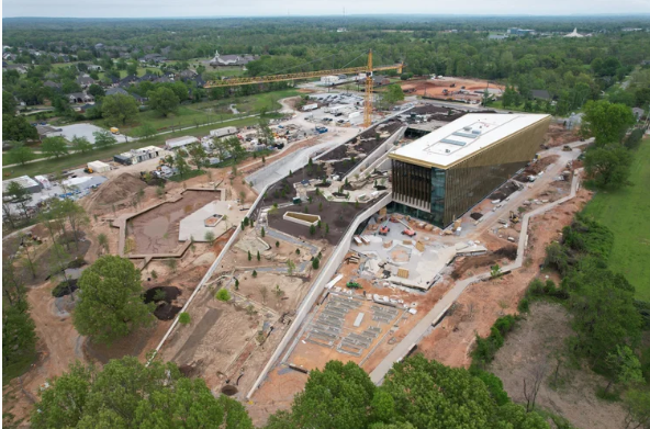
At MN Drone Pilot in Minnetrista, Minnesota, we offer professional aerial surveys and inspection services to help clients gather accurate visual and spatial data with efficiency and precision. Leveraging advanced drones and imaging sensors, we capture detailed overhead perspectives for land analysis, construction verification, infrastructure assessment, environmental review, and property documentation. Our aerial workflow eliminates the need for scaffolding, climbing, or heavy field surveying equipment while maintaining strong measurement accuracy and safety compliance.
This service is ideal for engineers, developers, surveyors, architects, environmental firms, commercial property owners, and municipal departments who require dependable visual intelligence for decision-making. We provide detailed coverage for buildings, utilities, agricultural land, access corridors, drainage areas, grading progress, and site assets. Our deliverables may include high-resolution imagery, geo-referenced files, video documentation, and reporting formats tailored to project scope.
Aerial surveys and inspections help reduce field time, minimize human risk, improve project alignment, and provide visual clarity for stakeholders. Whether it’s pre-construction analysis, compliance documentation, or structural evaluation, MN Drone Pilot is committed to accuracy, communication, and professional data delivery.
📌 contact MN Drone Pilot for service estimates.