Property Mapping
-
0 sales
- 334 views
- 3 Hours Response time
- $0.00 No travel charge
- Save
0 /5.0
User review
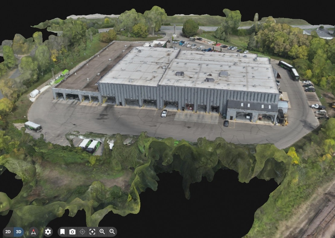
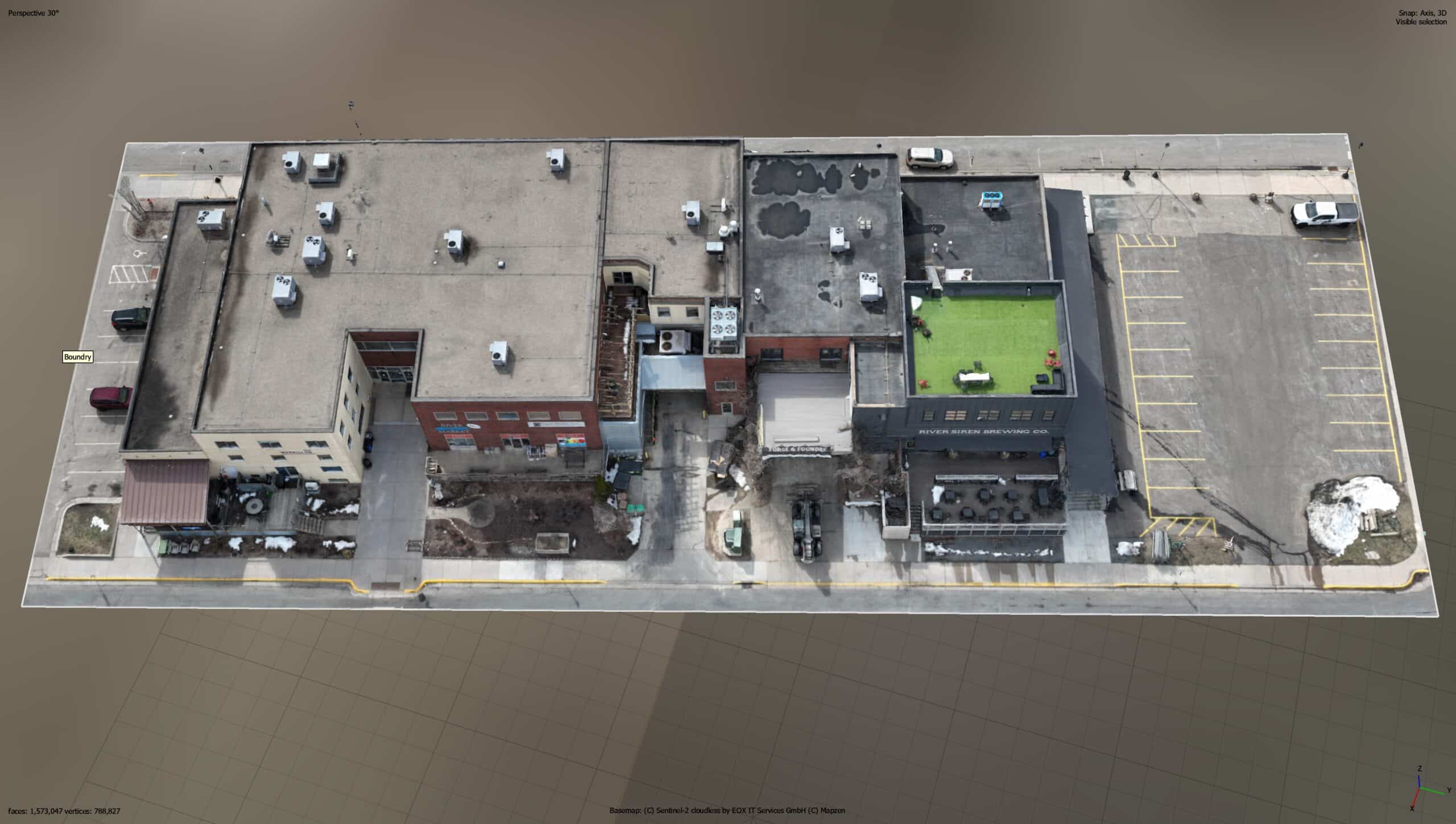
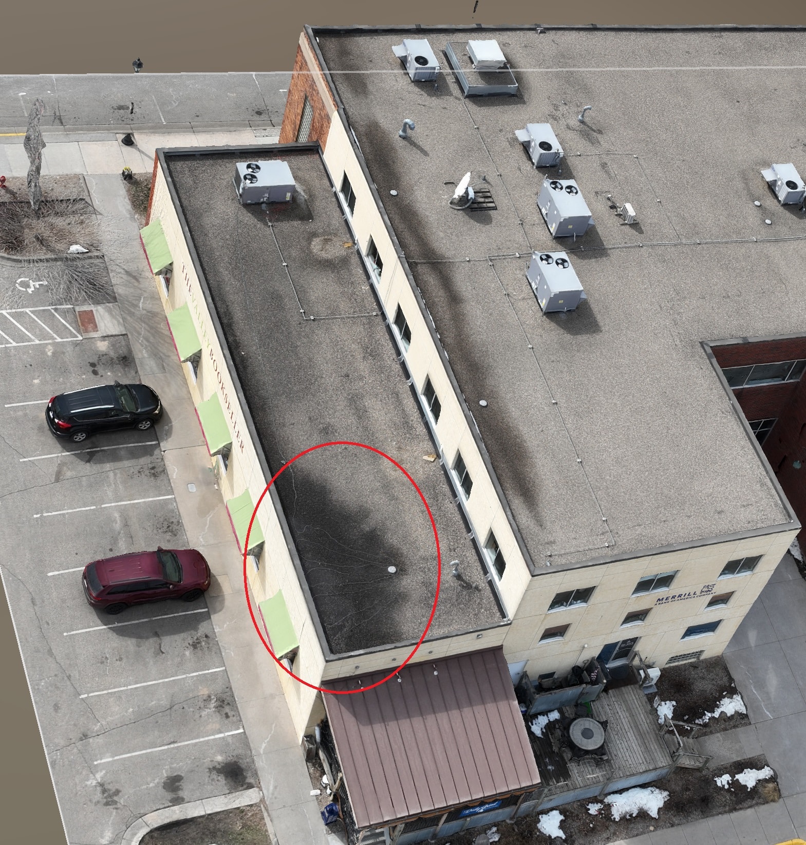
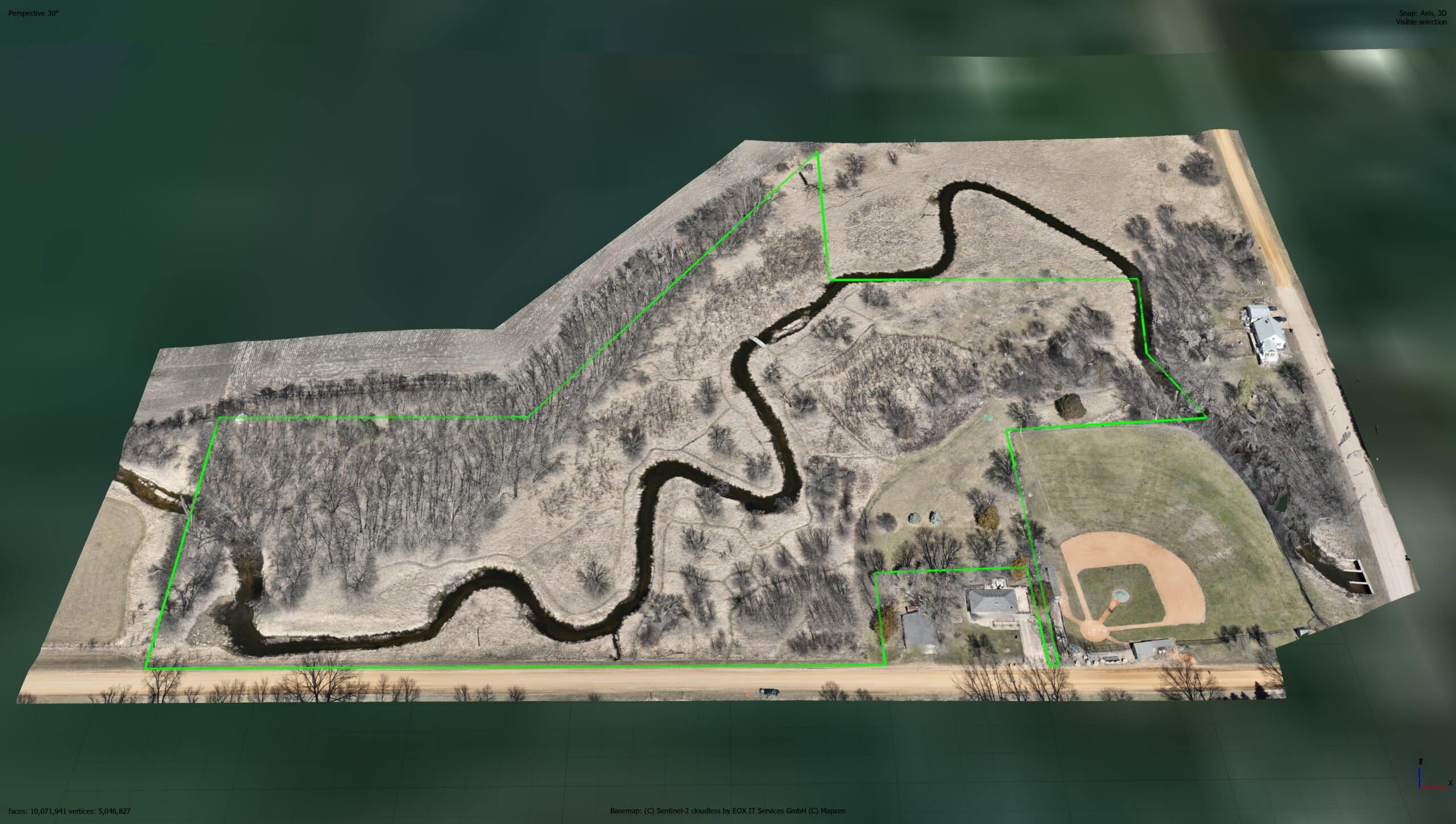
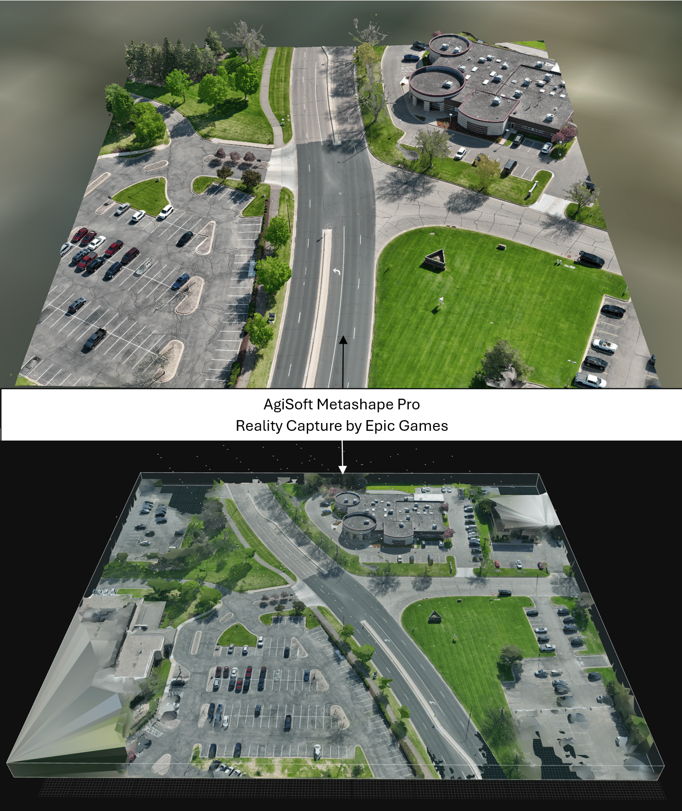


This service is for those who need an entire property or area in one high resolution image. Orthomosaic maps are a combination of many photos stitched together. From that, we can build 3D models, Digital elevation models, maps with contour lines, and 3D point clouds. Maps can be used for planning, centimeter accurate measurements, and annotation markings.
Please contact us to discuss the needs of your project. We will develop a quote based on the deliverables you need.
We do have the ability to do survey accurate geolocation mapping.
***We are not a surveying service but gladly work with surveyors who need aerial data collection.
Additional services
-
Travel outside of 15 miles from office – per hour, round trip.
$40.00
-
GNSS RTK use
Use of RTK service with Emlid Reach 3 base station.$85.00