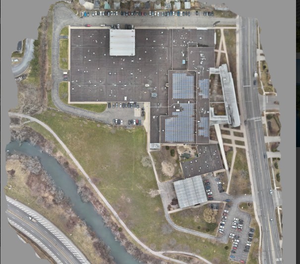
Orthomosaic Mapping by South Alabama Drones in Pike Road, Alabama produces highly accurate, distortion-free aerial maps stitched from hundreds of precisely captured drone images. These maps provide survey-grade clarity and can be used for land assessment, construction planning, environmental monitoring, real estate documentation, and agricultural management.
Each orthomosaic is corrected for perspective, elevation variation, and lens distortion—resulting in a true-to-scale top-down map with exceptional detail. These maps can identify property boundaries, surface conditions, vegetation changes, building placement, and site progress. They are ideal for surveyors, developers, land managers, and engineers.
We provide data compatible with CAD, GIS, and modeling software, enabling seamless integration into professional workflows. With consistent flight paths and precision GPS, South Alabama Drones ensures highly reliable and repeatable mapping results throughout Alabama.
Create high-resolution orthomosaic maps by stitching together aerial images to provide detailed, accurate representations of large areas.