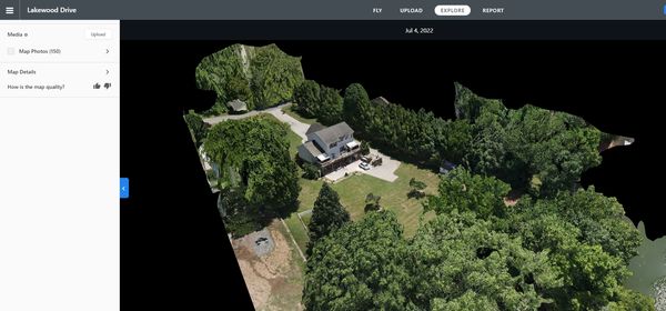


High-precision aerial mapping and spatial data acquisition delivering up-to-date orthomosaic maps, 3D surface point models, and RTK-corrected aerial data for land development and engineering projects in Knoxville, Tennessee.
Capabilities & Services Offered:
-
Current Orthomosaic Photography: High-detail aerial maps with accurate property area outlines, presenting current site conditions superior to outdated satellite imagery.
-
3D Surface Model Capture: Photogrammetric image capture generating interactive 3D digital structural and topographic models.
-
RTK Correction & LIDAR Data: Advanced sensor integration for precise, georeferenced spatial measurements and topographic mapping.
Location
Fequently asked questions
Why choose drone orthomosaic mapping over online satellite imagery?
Satellite maps can be years out of date, whereas drone orthomosaics capture property boundaries and features as they exist today with higher resolution.