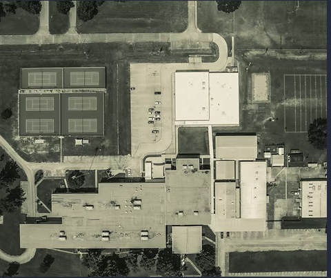
At rmdroneimages in Coffeyville, Kansas, we offer advanced aerial mapping and photogrammetry services that transform real-world environments into highly detailed, measurable digital models. Using precision flight planning and high-resolution overlapping image capture, we generate accurate 2D orthomosaic maps, 3D reconstruction models, elevation data, and contour outputs suitable for project planning, surveying assistance, land development, construction, agriculture, and environmental monitoring.
Our photogrammetry results help clients assess terrain, track earthwork, document boundaries, map infrastructure, analyze vegetation patterns, measure surface areas, and evaluate site planning conditions without traditional manual surveying obstacles. This service provides valuable insight for engineers, surveyors, developers, contractors, GIS teams, utility providers, and agricultural managers seeking reliable visual and geospatial data.
Files can be delivered in multiple formats for visualization, planning, reporting, or integration into project management and CAD environments. Photogrammetry enhances accuracy, operational efficiency, and decision-making while reducing time spent in the field.
📌 please contact rmdroneimages for mapping specifications and project-based quotes.