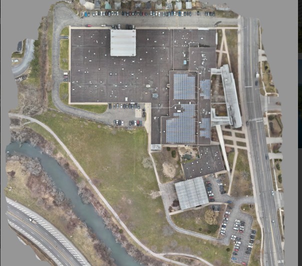
Infrastructure & Construction services by Hopewell Aerial Photography help teams manage projects more effectively with consistent, high-quality aerial documentation from start to finish. Our drone technology provides clear overhead and angled perspectives that reveal site conditions, work progress, safety risks, material placement, and structural details that would otherwise be difficult to monitor from the ground. This service is invaluable for builders, developers, engineers, architects, and project managers who require accurate updates and visual records.
We capture progress photos, excavation stages, concrete pours, framing, roadway work, utility installations, and large-scale infrastructure projects. Each flight is performed with precise planning to ensure consistent flight paths and repeatable visual comparisons week after week or month after month. Our aerial photographs help teams verify work completion, improve communication, and prevent costly delays by identifying issues early.
These visuals support project reporting, investor updates, marketing presentations, safety reviews, and documentation for compliance or permits. All images are fully edited and delivered in a clean, organized format that makes reviewing and sharing simple.
Hopewell Aerial Photography provides construction and infrastructure documentation that enhances oversight, protects project timelines, and strengthens collaboration across Ohio’s building and development sectors.