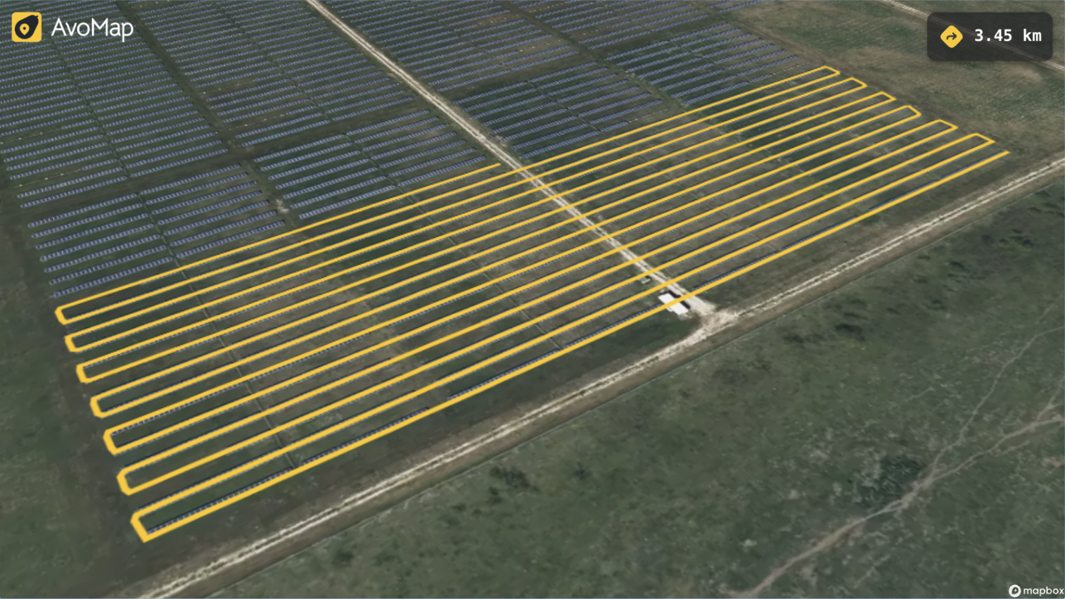
Get custom AvoMaps videos that visualize your drone flight paths—perfect for client presentations, pre-mission planning, and approvals. Delivered fast, clear, and professionally tailored to your project.
Visualize your drone flight plans with cinematic precision using AvoMap. I’ll turn your flight path data (GPX/KML/KMZ) into a stunning, professional 3D video you can use for client approval, mission planning, or post-flight reporting.
What’s Included:
- ✔️ Import and processing of your GPX or KML flight path files
- ✔️ Fully animated 3D map route with realistic camera movements
- ✔️ Custom map markers, waypoints, and labels for key POIs
- ✔️ Adjustable zoom, rotation, and altitude settings for optimal clarity
- ✔️ Background music or voiceover (optional, if requested)
- ✔️ Quick turnaround and direct support for edits or revisions
- ✔️ Delivered in MP4 format, ready for client use or internal review
Perfect for:
Licensed drone pilots who want polished visuals for property shoots, inspections, construction sites, or mapping projects.
Boost your drone operations with bespoke 3D flight path videos crafted using AvoMap. By importing your GPX, KMZ or KML files, I create detailed animations that showcase your planned routes with precision. These videos are invaluable for client presentations, mission planning, and securing approvals. With customizable features like map markers, labels, and various export options. You'll receive content tailored to your specific needs. Trust in a service that combines technical expertise with a commitment to delivering high-quality, professional visuals promptly.