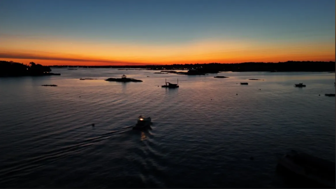
Environmental projects demand accuracy, detail, and a clear view of the landscape. At Nova Aerial Services, our Environmental Assessment Photography provides high-resolution drone imagery to support research, planning, and long-term monitoring of sensitive ecosystems and development sites.
Using advanced drone technology, we capture wide-area overviews and detailed perspectives that are often difficult or costly to obtain through traditional surveying methods. Our aerial imagery is ideal for documenting wetlands, forests, agricultural land, waterways, and land-use changes, helping researchers and organizations make informed decisions with confidence.
For environmental researchers and agencies, our services provide valuable documentation for compliance, conservation studies, and ecosystem monitoring. For developers and planners, drone imagery offers an efficient way to evaluate terrain, identify potential challenges, and ensure projects align with sustainability and regulatory standards.
By delivering clear, comprehensive visuals, we help bridge the gap between progress and preservation. Our team works with precision and professionalism to provide the data you need, while minimizing disruption to sensitive areas.
👉 Reach out today to discuss your environmental project and receive a custom quote tailored to your needs.