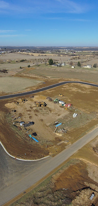

Advanced aerial data capture and high-density spatial imaging tailored to support civil engineers, architects, land developers, and general contractors during site planning and feasibility studies.
Capabilities & Services Offered:
-
High-Density Data Capture: Aerial imaging capable of capturing up to 9,000 data points from a single photographic frame.
-
Fieldwork Enhancement: Rapid aerial survey data to inform site layouts, environmental reviews, and design decisions.
-
High-Resolution Site Overviews: Detailed aerial visual records replacing basic snapshots with comprehensive site perspectives.
-
Engineering & Architectural Integration: Spatial visual outputs formatted to assist planning teams and design consultants.
Location
Fequently asked questions
How does aerial data capture improve site planning compared to traditional photos?
Advanced aerial imagery captures thousands of precise data points per frame, giving engineers and architects reliable spatial insights to streamline fieldwork.