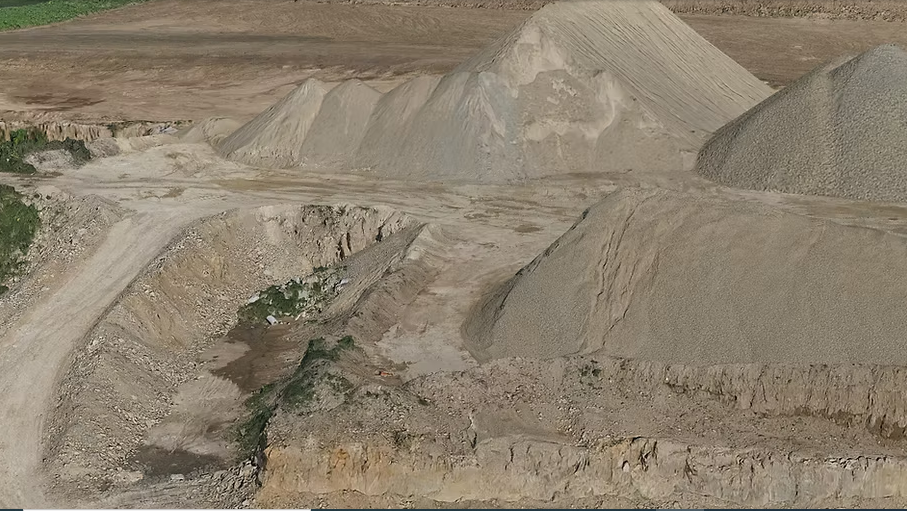
Earthwork and pile estimations are crucial for accurate project planning, budget allocation, and efficient construction execution. At Flyover Drone Services in Glendale, Arizona, we provide advanced drone-based earthwork and pile calculations that eliminate guesswork and deliver precise, data-driven results. Using high-resolution aerial mapping, LiDAR technology, and photogrammetry, we capture detailed site information that traditional methods often miss. Our measurements help engineers and contractors understand cut-and-fill volumes, soil movement requirements, and material quantities with accuracy and speed.
With drone technology, we cover large areas in significantly less time, reducing manpower and ensuring safer operations by minimizing ground-based surveying in hazardous zones. Our accurate 2D and 3D models support progress tracking, volume comparisons, and verification against design plans. Whether it’s for initial planning or ongoing monitoring, our earthwork and pile estimation reports help clients stay compliant, remain on schedule, and avoid costly errors.
Flyover Drone Services delivers fast turnarounds, reliable data, and professional reporting tailored to your project needs. Our commitment to precision ensures that every stakeholder—from project managers to engineers—has the actionable information needed for confident decision-making throughout the construction process.
Track buckets.
One 3D model allows you:
-
Topography / elevation
-
Slopes / grades
-
Cubic yards / quantities
A second flight allows you:
-
Topography changed
-
Grades changed
-
Cubic yards moved