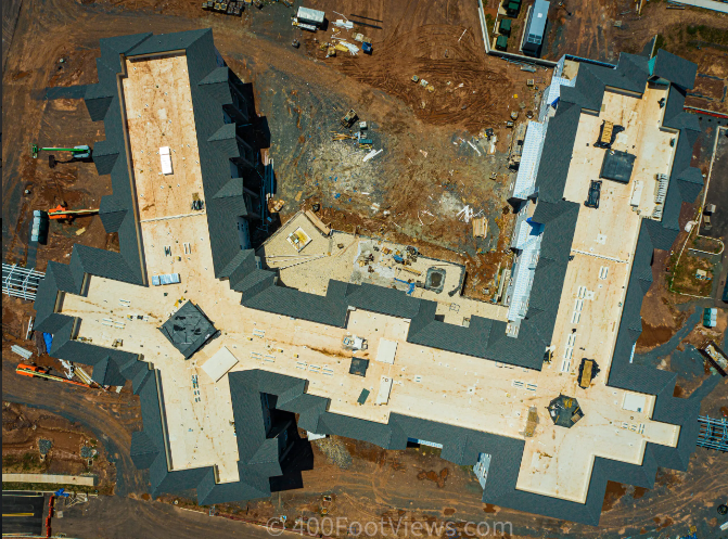
At 400footViews in Pennsylvania, we help construction professionals stay informed and in control with comprehensive drone-based construction documentation. Our aerial services provide a complete interactive view of your job site, including high-resolution maps, photos, panoramas, and videos. Compare real-time site conditions with pre-construction plans, track progress visually, and share clear updates with stakeholders.
Our Construction Drone Services improve communication between project managers, contractors, and investors by delivering a visual timeline that highlights each phase of development. With aerial data captured within days—not weeks—you can monitor changes, detect issues early, and maintain transparency across your team.
We tailor each package to your needs and budget, offering:
✅ Interior & Exterior Photography
✅ Aerial & Drone Imaging
✅ Time-Lapse & Progress Videos
✅ Completion Photography
✅ Professional Editing & Retouching
✅ Multi-Format Delivery
Whether you’re building commercial, residential, or industrial projects, 400footViews ensures you have accurate, timely imagery to support reporting, inspections, and client communication.
💲 Pricing is custom — contact 400footViews in Pennsylvania today for a personalized quote.