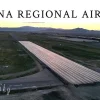
Understanding the full layout of your land is essential for smart planning and development. With iFlyBigSky’s Aerial Site Survey services, we deliver detailed, high-resolution aerial imagery that provides a comprehensive picture of your property’s terrain, boundaries, and natural features.
Using advanced drone technology, we capture precise data quickly and safely, producing accurate maps and survey visuals that support better decision-making. This service is ideal for developers, architects, engineers, and landowners who need reliable insights for planning new projects, managing resources, or monitoring ongoing work.
Traditional surveys can be time-consuming, costly, and limited in scope. Our aerial approach covers large areas in a fraction of the time, offering a more efficient and cost-effective solution. Whether you’re evaluating land for construction, visualizing agricultural use, or preparing presentations for stakeholders, aerial surveys provide the clarity and confidence you need.
With iFlyBigSky, you’ll gain a bird’s-eye perspective that reveals details you may otherwise miss, empowering you to make informed decisions about your land.
💲 Every property is unique — contact iFlyBigSky today to schedule your aerial site survey and receive a personalized quote tailored to your project.

