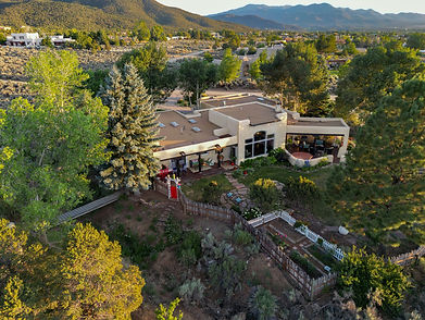
FAA certified commercial drone photography delivering elevated aerial perspectives to showcase property boundaries, land acreage, surrounding landscapes, and neighborhood contexts.
Capabilities & Services Offered:
-
High-Resolution Aerial Stills: Crisp overhead views highlighting entire property footprints, roofing, and surrounding acreage.
-
Regional Landscape Context: Aerial perspectives capturing the unique terrain and mountain backdrops of Northern New Mexico.
-
FAA Certified Operations: Fully compliant commercial drone flights executed by an FAA certified drone photographer.
-
Real Estate & Commercial Integration: Aerial visual assets formatted for MLS listings, marketing brochures, and digital campaigns.
Location
Fequently asked questions
Is the drone operator commercially licensed by the FAA?
Yes, all aerial drone photography is conducted by an FAA certified commercial drone photographer.
How does aerial photography benefit property listings in Northern New Mexico?
Aerial views effectively highlight large land parcels, property boundaries, and the surrounding mountain landscapes unique to the region.