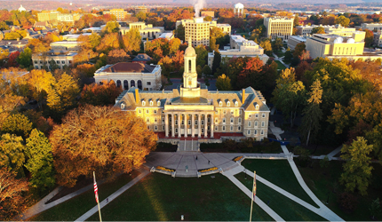


High-resolution aerial video and photo capture combined with Matterport 3D imaging and spatial point cloud deliverables.
Capabilities & Services Offered:
-
High-definition 4K video recording and high-resolution still photography from aerial perspectives.
-
Interactive Matterport 3D visual captures.
-
Digital spatial point cloud generation for engineering and architectural modeling.
-
Comprehensive site overviews for marketing, planning, or inspection.
Operations provided under Aerial Imagery services. Contact directly via the client portal to schedule flight shoots.
Location
Fequently asked questions
What video and photo resolution options are provided for aerial captures?
Visual media is captured using the latest 4K HD video standards and high-resolution still photography.
Can aerial imagery be converted into 3D structural data?
Yes, aerial services include Matterport 3D capture and point cloud creation for spatial analysis.