3D Mapping & Orthomosaic Mapping in panama city by DronEyeSolutions
-
0 sales
- 91 views
- 3 Hours Response time
- $0.00 No travel charge
- Save
0 /5.0
User review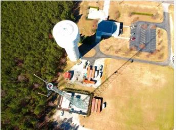

Leverage advanced drone technology to create highly detailed 2D maps and
3D digital elevation models with up-to-date aerial data.
Service Highlights:
✅ High-Resolution 3D Digital Models – Get accurate topographic data
✅ Orthomosaic Mapping – Precision-stitched aerial imagery
✅ Fill Gaps Left by Satellite Mapping – Obtain real-time, detailed maps
✅ Ideal for Construction, Agriculture, & Land Surveying
✅ Georectified for Accurate Spatial Data
Contact us today for a consultation and quote!
Mentioned rates per hour