Enhance Your Geospatial Analysis with Drone.vet’s Orthomosaic Mapping Services
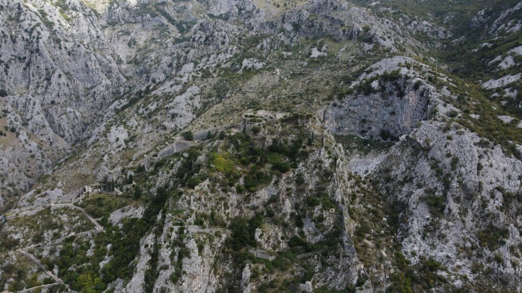
Unlock the full potential of aerial mapping with Drone.vet’s advanced orthomosaic mapping services. Utilizing high-precision drones equipped with top-tier cameras and sensors, our licensed pilots capture detailed aerial photographs that are stitched together to create a single, highly accurate orthomosaic map. This service is invaluable for professionals in urban planning, agriculture, environmental conservation, and construction, providing a detailed, bird’s-eye view that supports thorough analysis and informed decision-making.
What is Orthomosaic Mapping?
Orthomosaic mapping involves merging overlapping aerial photographs into one large, seamless image. Unlike standard aerial or satellite images, orthomosaic maps are corrected for topographic relief, lens distortion, and camera tilt to ensure accurate representation of the Earth’s surface. This high-resolution map provides up-to-date data that is critical for various applications, offering an accurate, scalable tool for detailed geographic analysis.
Benefits of Drone.vet’s Orthomosaic Mapping:
High Accuracy and Resolution: Our orthomosaic maps offer unparalleled detail and precision, making it easy to conduct measurements, plan developments, or monitor environmental changes directly from the imagery.
Efficient Data Collection: Cover large areas quickly compared to traditional ground survey methods, reducing time in the field and speeding up the data collection process.
Cost-Effective: By streamlining the data collection process, our service reduces overall project costs associated with large-scale mapping projects.
Versatile Applications: From precision agriculture and forestry management to urban planning and disaster response, orthomosaic maps provide a foundation for robust analysis and strategic planning.
Our Orthomosaic Mapping Services Include:
Aerial Image Capture: We conduct extensive aerial surveys, ensuring comprehensive coverage of your specified area with high-overlap imagery for precise stitching.
Advanced Image Processing: Our experts use cutting-edge software to stitch images and correct for any distortions, resulting in highly accurate and usable maps.
GIS Integration: Easily integrate our orthomosaic maps into GIS software for further analysis, layering, and project planning.
Customizable Deliverables: Depending on your project needs, we provide orthomosaic maps in various formats, resolutions, and specifications.
Why Choose Drone.vet?
At Drone.vet, we combine technical mapping expertise with advanced drone capabilities to deliver superior orthomosaic mapping services. Our pilots are experienced in navigating diverse landscapes and our analysts are skilled in geospatial data processing, ensuring top-quality results for every project.
Engage with Drone.vet Today
Transform your spatial analysis and project planning with our state-of-the-art orthomosaic mapping services. Contact Drone.vet to discuss your needs or to schedule a mapping project. Visit our website to explore detailed examples of our work and learn more about how our orthomosaic maps can benefit your organization.
With Drone.vet, you gain access to comprehensive, accurate, and actionable geospatial data that can dramatically enhance your project outcomes and decision-making processes.