Unlock Precision with Drone.vet’s Photogrammetry Services
Welcome to Drone.vet, where we specialize in providing advanced photogrammetry services using state-of-the-art drone technology. Our licensed pilots are experts in capturing detailed aerial data, transforming images into precise 3D models and maps. Whether you’re in construction, real estate, agriculture, or environmental science, our photogrammetry solutions are tailored to meet your project’s specific needs.
What is Photogrammetry?
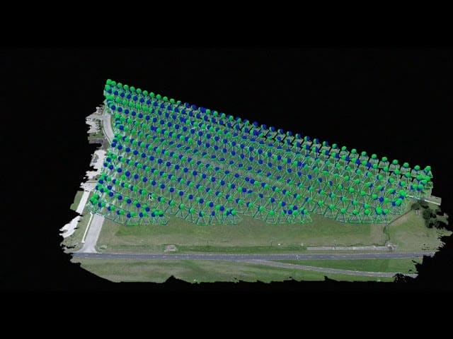
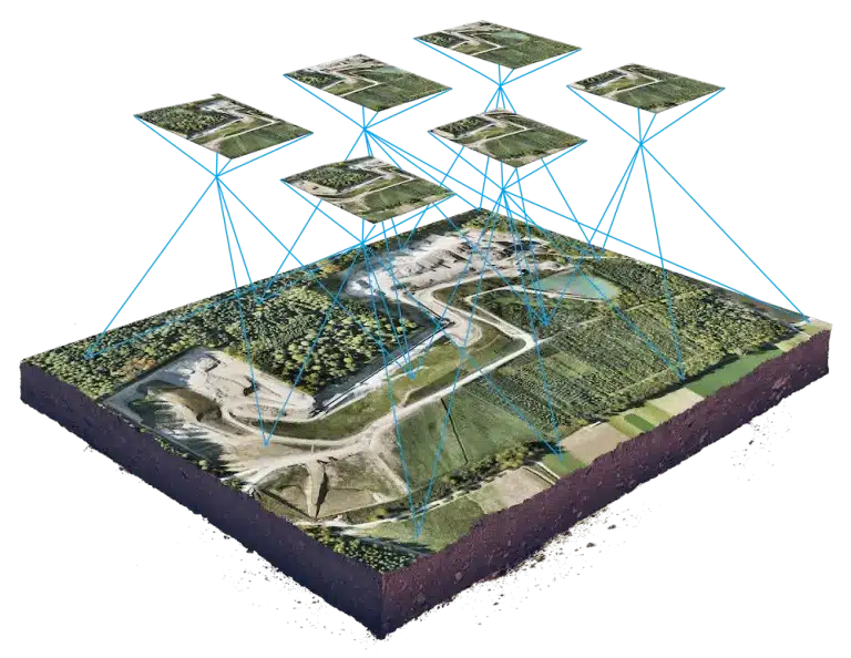
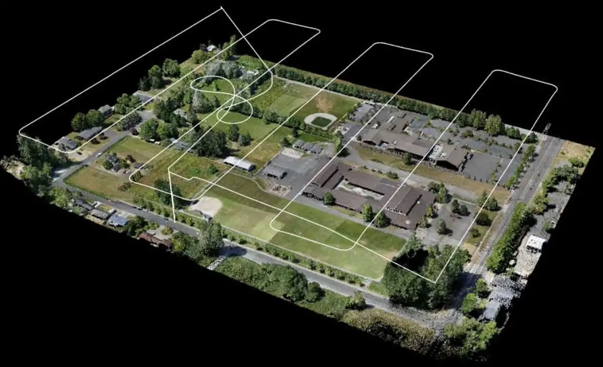
Photogrammetry is the science of making measurements from photographs. By using drones equipped with high-resolution cameras, we can capture numerous images of a property or landscape from different angles. These images are then processed to create accurate 3D models, maps, and other data-rich visualizations.
Advantages of Drone-based Photogrammetry:
High Accuracy and Resolution: Our drones capture extremely detailed images, which are essential for creating accurate 3D representations and measurements of land features.
Cost-Effective: Drone photogrammetry is a cost-effective alternative to traditional surveying methods. It reduces the need for manual labor and expedites the data collection process.
Versatile Applications: From surveying land for construction planning to monitoring crop health in agriculture, photogrammetry serves a wide range of applications that require detailed geographic data.
Safe and Efficient: Drones can access difficult or dangerous terrain without the risks associated with sending human surveyors.
Our Photogrammetry Services Include:
Detailed Terrain Mapping: Ideal for construction sites, landscape architects, and urban planners who need detailed topographical data.
Volumetric Measurements: Calculate precise volume measurements for mining, waste management, and material stockpiles.
Asset Management: Track and manage assets over large areas, such as pipelines, solar farms, and infrastructure networks.
Agricultural Analysis: Evaluate soil conditions, plan irrigation systems, and monitor crop growth over time.
Why Choose Drone.vet for Your Photogrammetry Needs?
At Drone.vet, we combine technical expertise with advanced drone capabilities to deliver high-quality photogrammetry services. Our pilots are rigorously trained and experienced in aerial data capture and are fully licensed, ensuring that all operations are conducted safely and in accordance with legal regulations.
Get Started with Drone.vet Today:
Elevate your project’s precision and efficiency by choosing Drone.vet for your photogrammetry needs. Contact us today to discuss how we can assist with your specific requirements or to schedule a session with one of our expert drone pilots. Explore our website to learn more about our full range of aerial imaging services and see how we can help turn your project visions into reality.
Make the smart choice for detailed, accurate aerial data. Choose Drone.vet for reliability and precision in every flight.
Have questions or just need a gentle landing-hand? Contact the team at Drone.vet! Our support crew would be happy to help anytime! Email us at [email protected] or give us a call at +1 929-299-2410.


