
-
Aerial Photography and Videography
-
Aerial Photos and Videos
-
Drone Aerial Photography
-

Photography
-
Real Estate
-
360 Photography Tour
-
Real Estate Photography
-
Residential Real Estate
-
Real Estate & Short-Term Rental Photography
-
Real Estate Aerial
-
Real Estate Outdoor Photo and Video
-
Real Estate Outdoor Video Package
-
Residential Photography
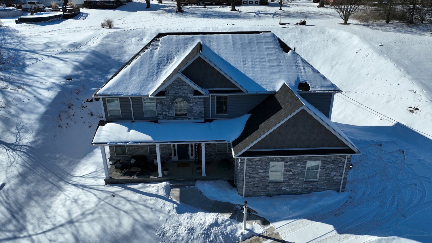
Transform how residential properties are presented to buyers with professional residential real estate drone photography in Pittsburgh, PA. Infinitum Imagery LLC provides high-definition aerial visual solutions engineered to capture homes, expansive land acreage, and surrounding neighborhood contexts across Pittsburgh and Western Pennsylvania. Operating as an FAA Part 107 certified drone service provider, our remote pilots utilize advanced UAV platforms to record crisp high-altitude photography, cinematic 4K video passes, and immersive 360-degree aerial panoramas that highlight property boundaries and regional proximity.
From single-family home listings to sprawling suburban estates, our aerial real estate photography gives prospective buyers a clear, comprehensive perspective of a property's true footprint. We tailor every flight plan to the specific topography of the site, ensuring optimal daylight capture and elevation angles. Raw aerial media is professionally processed and edited to deliver polished, MLS-ready image assets that help real estate agents, brokers, and private sellers attract serious inquiries and accelerate sales cycles across the Pittsburgh market.
Key Details & Capabilities:
-
Residential Real Estate Drone Photography in Pittsburgh, PA: High-resolution aerial photography capturing property lines, exterior architecture, and neighborhood context.
-
360-Degree Aerial Panoramas: Interactive elevated panoramas offering prospective buyers a full contextual view of the property surroundings.
-
Cinematic 4K Aerial Video Tours: Smooth flyover video passes illustrating home entrance approaches, rooflines, and backyard layouts.
-
FAA Part 107 Certified Flight Operations: Fully compliant commercial drone flights executed by licensed remote pilots carrying proper operational safety protocols.
Location
Fequently asked questions
Why hire Infinitum Imagery LLC for residential real estate drone photography in Pittsburgh, PA?
Aerial drone imagery provides a high-vantage overview of roof conditions, land scale, and neighborhood boundaries that standard ground-level real estate photography cannot convey.
Who operates the drone flights for residential property media shoots?
All flight operations are conducted directly by FAA Part 107 certified remote pilots holding commercial operator credentials.
What regional areas are covered for real estate aerial photography?
Field operations cover the entire city of Pittsburgh and surrounding communities throughout Western Pennsylvania.