
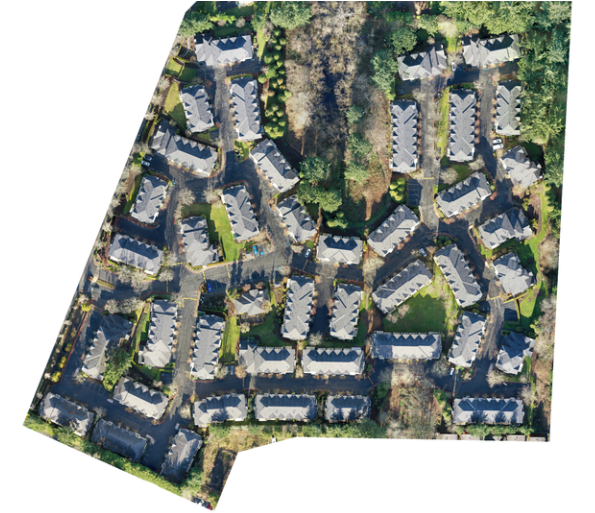

Orthomosaic mapping is one of the most powerful tools for surveying, measuring, and documenting large areas with precision. H&H Drone Services, LLC in Royse City, Texas provides high-accuracy orthomosaics created through advanced drone photogrammetry techniques. Our drones capture hundreds or thousands of overlapping images, which are then processed into a single, distortion-free, georeferenced map that delivers exceptional detail.
These orthomosaic maps are ideal for construction planning, land development, environmental monitoring, agriculture, real estate, and infrastructure projects. With precise ground sampling resolution, clients can view, analyze, and measure property features with confidence. Orthomosaics allow teams to calculate distances, assess site changes over time, generate reports, and maintain accurate project documentation.
Our mapping solutions enhance workflow efficiency, reduce the need for labor-intensive ground surveys, and significantly improve project safety by eliminating the need to physically access difficult terrain. From small properties to large tracts of land, we provide data that is clear, reliable, and ready for integration into your GIS or planning software.
H&H Drone Services, LLC delivers fast turnaround and professional results, making orthomosaic mapping accessible, affordable, and highly accurate.
Contact H&H Drone Services, LLC for custom quotes.