
✅ Drone Photography
FAA-certified drone pilot providing high-quality aerial photography.
Professionally edited images with color correction, contrast, and dynamic range enhancement.
Pricing: Varies based on project scope—contact for a quote.
✅ Drone Videography
Capturing cinematic-quality drone footage with expert composition and lighting.
Pre-planned flights for optimal weather and lighting conditions.
Provides individual clips for marketing or fully produced videos with music, text, and logos.
✅ 360-Degree Panoramas
Fully immersive panoramas for real estate, attractions, and commercial properties.
Allows website visitors to explore locations with a realistic, interactive view.
✅ Aerial Real Estate Photography & Videos
Ideal for landowners, brokers, and agents to showcase large properties.
Drone footage provides an enhanced perspective, with optional 360-degree panoramas.
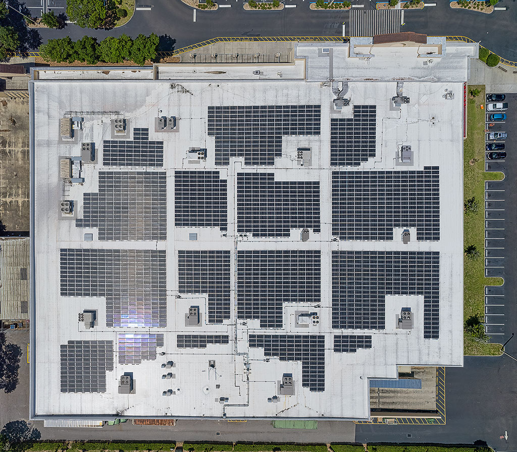
✅ Drone Inspections & Monitoring
Roof Inspections: Safe and efficient aerial inspections of hard-to-reach areas.
Reduces risks and costs compared to traditional inspection methods.
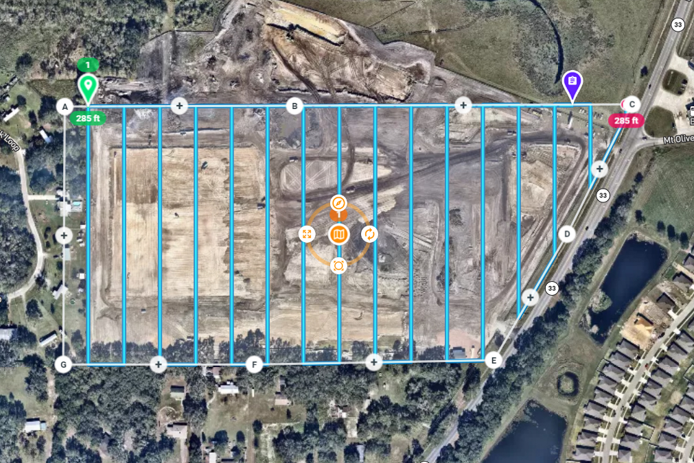
✅ Orthomosaic Mapping
High-resolution aerial images corrected for distortion, perspective, and relief.
Utilizes specialized drone software to stitch multiple images into a single, large-scale map.