Precision Data Collection for Surveyors Using Drones | Argosuas
-
0 sales
- 153 views
- 3 Hours Response time
- $0.00 No travel charge
- Save
0 /5.0
User review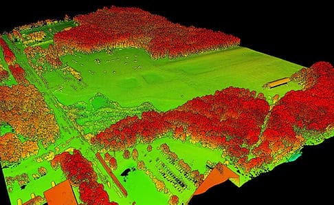
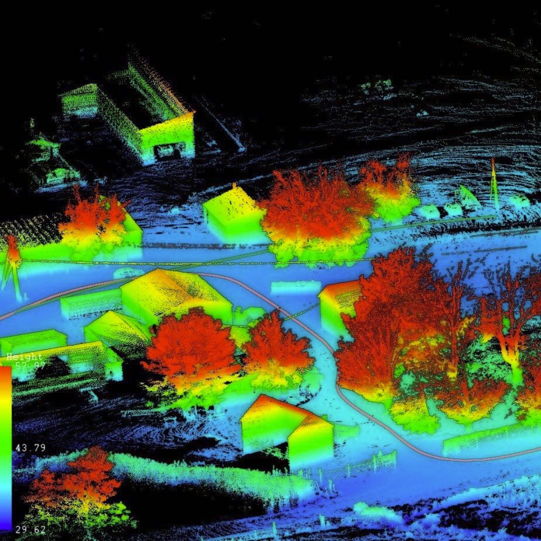
At Argosuas, we specialize in precision data collection to support professional land surveyors in their critical work. As the integration of remote data becomes an essential tool in the surveying field, our advanced drone technology facilitates the efficient gathering of high-quality data needed to meet the National Map Accuracy Standards for survey and mapping products.
By coupling our remote data collection with certified ground control, surveyors can produce accurate mapping data that enables them to get the job done right the first time, and in record time. Our drones capture detailed aerial imagery and topographical data, significantly enhancing the accuracy and speed of the surveying process.
Choose Argosuas for your data collection needs and benefit from our expertise in drone technology. We are committed to helping surveyors streamline their workflows and achieve precise, reliable results. Contact us today to learn how our drone data collection services can elevate your surveying projects!